CITY OF CRUSTARA
Saporia
The agricultural heart of Crustara, shaped by the Dulcis River, a vast canal network, and the farms, orchards, vineyards, and ranchlands of the southern plains.
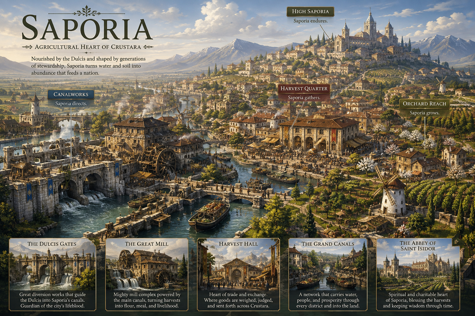
In Saporia, water, agriculture, trade, and civic life are inseparable.
A City Shaped by Water
The Dulcis River runs through Saporia’s fertile basin and feeds an extensive network of canals, locks, watergates, mill races, and irrigation channels. Generations of engineering turned that water into the foundation of the city’s economy and the surrounding countryside.
Unlike denser Crustaran cities, Saporia blends gradually into its rural surroundings. Fields, orchards, working farms, vineyards, and waterways reach close to the urban core.
Four Districts
Each principal district expresses a different part of Saporia’s identity.
Canalworks
Saporia’s hydraulic and industrial heart: diversion works, canal junctions, locks, watergates, workshops, warehouses, maintenance yards, stone bridges, and the Great Mill.
Harvest Quarter
The commercial center of the city, with the Harvest Hall, produce markets, grain exchanges, storage houses, merchant offices, inns, loading basins, and food-processing workshops.
Orchard Reach
The place where city and countryside blur together—homes, smaller workshops, orchards, vineyards, gardens, ranch facilities, canal-fed fields, and footbridges sharing the same landscape.
High Saporia
A quieter district on higher ground, home to civic offices, schools, religious houses, established residences, public gardens, and a major abbey-basilica complex overlooking the agricultural basin.
The Agricultural Exchange
Harvest Hall acts as Saporia’s great market and agricultural exchange, supporting wholesale trade, quality inspection, guild activity, seasonal auctions, festivals, and distribution throughout Crustara.
From a distance, the city is defined by waterwheels, canal bridges, windmills, fruit trees, tiled roofs, barges, and cultivated land extending almost into the urban center.

